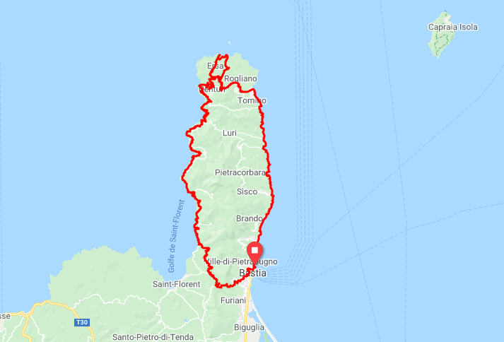
IN BRIEF
Stages: 4
Total distance: 148,8 km
Total elevation gain: 3619 m
Total riding time (net of stops): about 16-18 hours
Difficulty level: medium (except for the first stage, which is quite easy)
Below, at the end of the main article, you can see more details about the itinerary, (with the “stage by stage” GPS files), the right bike and clothing, the bike rental shops, plus tips about where to eat, sleep, tourist offices, monuments to visit, etc.
The “Mountain in the Sea”, the Island in the Island “, or the” Finger of Corsica”.
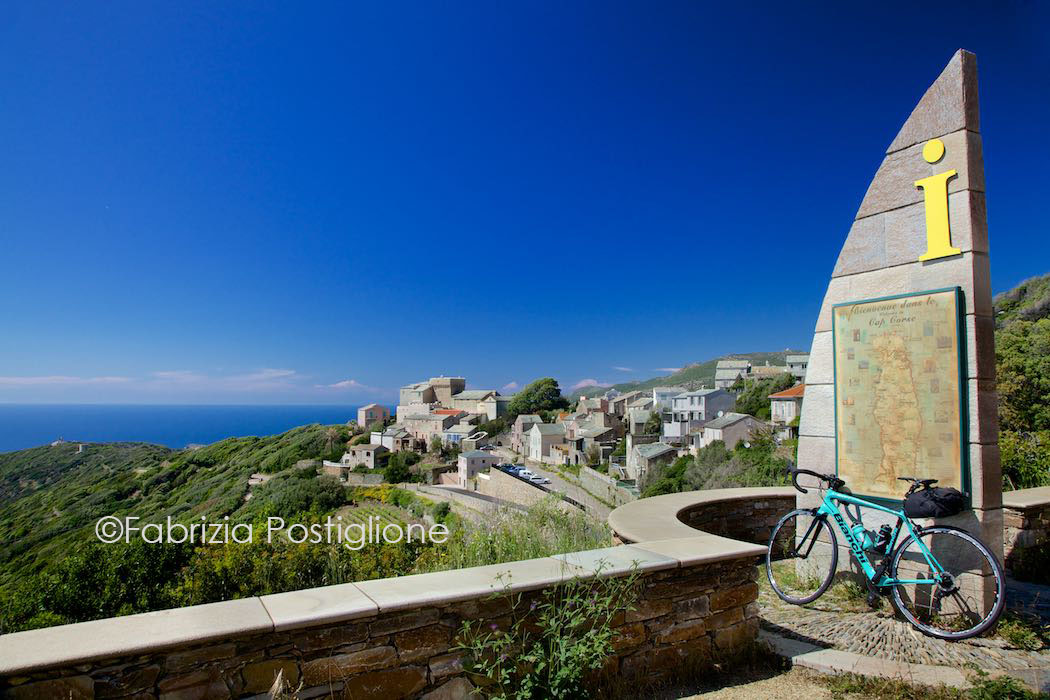
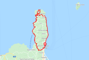
There is no shortage of evocative nicknames to define Capo Corso (the Corsica Cape), a fascinating vertical territory that protrudes from Corsica as a gigantic index finger – made of peaks, valleys, woods, ancient villages, loops and beaches – aimed as a warning to the Gulf of Genoa, in Italy.
Only forty kilometers long, this peninsula has a maximum width between 9 and 14 km and is planted like a fishbone in the Mediterranean. The spinal column is the Serra mountains, which exceed a thousand meters and, stretched for about 13 km between Brando and Luri villages, culminate in the 1322 meters of the Cima di e Follicie. From the mountain ridge, lateral valleys start perpendicularly (like fish thorns) towards the sea.
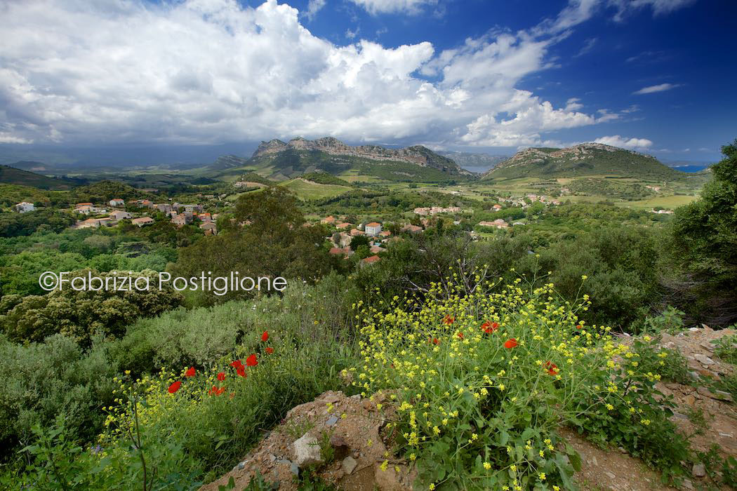
The east coast looks like a Mozart melody: effervescent, sunny, varied, brilliant as a waterfall: verdant and gentle valleys surrender to a sea that engages in a varied jade and turquoise palette. Sloping gently, the mountains create a jagged but never dramatic coast, occasionally dotted with paesoli (“villages” in Corsican language) of gray shale houses topped with slate roofs.
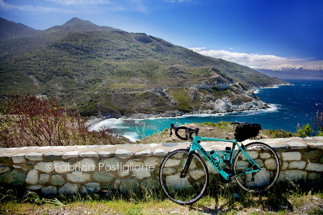
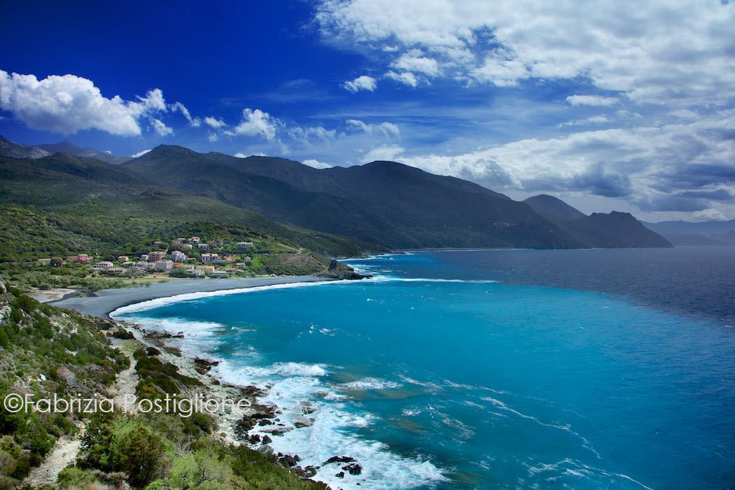
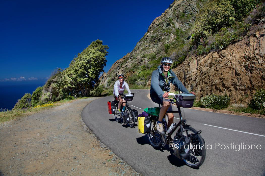
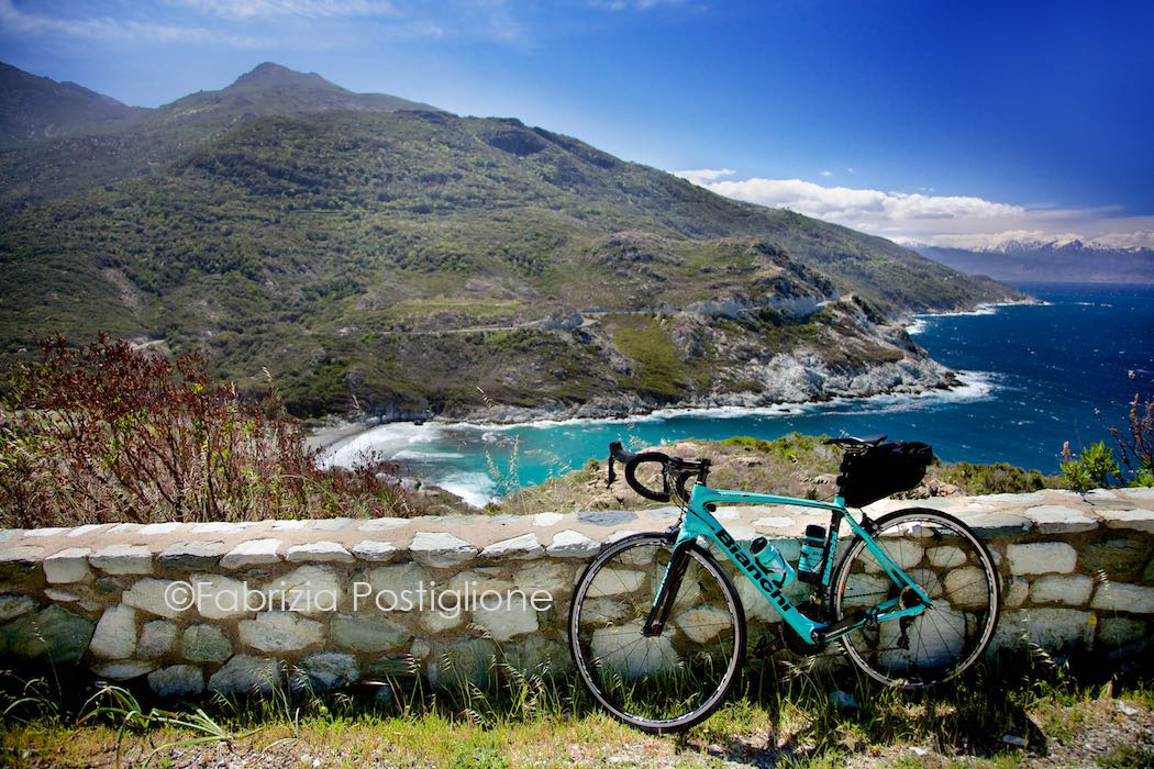
In the West there is a completely different music: Nature takes on a superhuman dimension, almost threatening in its rough beauty, and the dramatic majesty of Beethoven’s symphonies comes to mind. The cliffs plunge vertically for hundreds of meters into deep sapphire water and the bays seem to be carved out of the “spoon” of a capricious giant. Riding the bike, emotion (and dizziness) often take your breath away. The asphalt snake tangles to embrace the ravines, overcoming roughness, going down to caress black sand beaches or gray pebbles where man has built seaside villages with pastel houses and Lilliputian harbors. In a few places in the world you can pedal for such a long path always overlooking the sea. In fact, we will draw a ring around the “finger”, covering almost one hundred and fifty kilometers, most of which with amazing views of the Tyrrhenian Sea and the Ligurian Sea. By bike we will be able to savor every detail of this extraordinary peninsula, which motorists and motorcyclists, with their foot always pressed on the accelerator, will never be able to fully grasp, and we will be able to stop anywhere to instagram the most suggestive places.
 DAY 1: BASTIA-MACINAGGIO
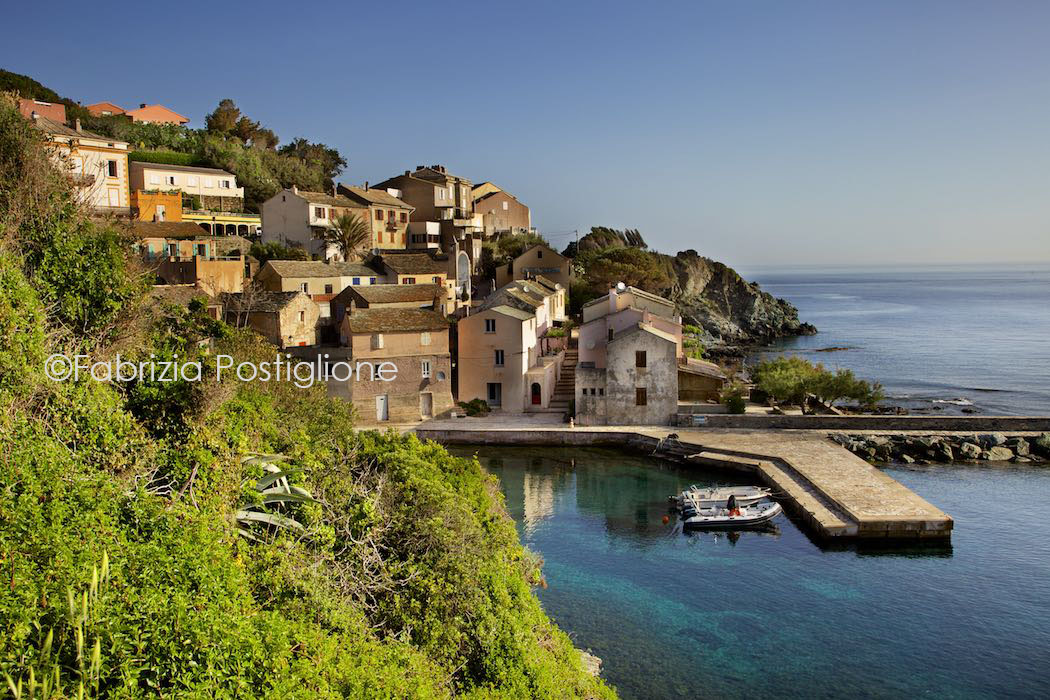
We leave shortly after dawn and, leaving the traffic of Bastia behind us, we head north. In the first kilometers, the most developed landscapes of the “satellite” seaside resorts of the second Corsican city (such as the Plage de Lavasina) flow, caressed by the golden rays of dawn. After a while, the silhouette of Erbalungastands out in the sea. This is one of the most beautiful villages in France, loved by artists and intellectuals. The yellow, orange, beige buildings and the gray crooked tower rise as if by magic from the blue crystal water. On the south side of the village there is a shale cliff from which to take a dip or go for a paddle with the Objectif-Nature kayaks. To the north of the handful of houses there is also a pebble beach, reachable by bike on the internal pedestrian street. After Erbalunga, the traffic clears a little, as do the agglomerations of houses, until the road descends to sea level at Marine de Sisco, a diving center, which offers a rather crowded beach of gray sand. For a quick swim, better opt for Pietracorbara, a little further north. The Tour de l’Osse, in the municipal area of Cagnano, is one of the dozens of anti-Saracen towers built in Corsica by the Maritime Republic of Genoa between 1530 and 1620. On clear days from here you can see the island of Capraia. A series of terraced agricultural plots announces the village of Porticciolo, which seems to have come out of a postcard, but until 1875 it was a thriving shipyard where a hundred and eighty ships were built. Shortly after, the road passes next to Cagnano beach: here you can take a dip with the bikes in sight. The marina of Santa Severa instills calm and serenity (and offers a safe harbor for pleasure boats). Further on we are tempted by the splendid shades of the Meria sea, ideal for a refreshing stop. Macinaggio, with 570 berths, is the largest leisure port of Capo Corso.
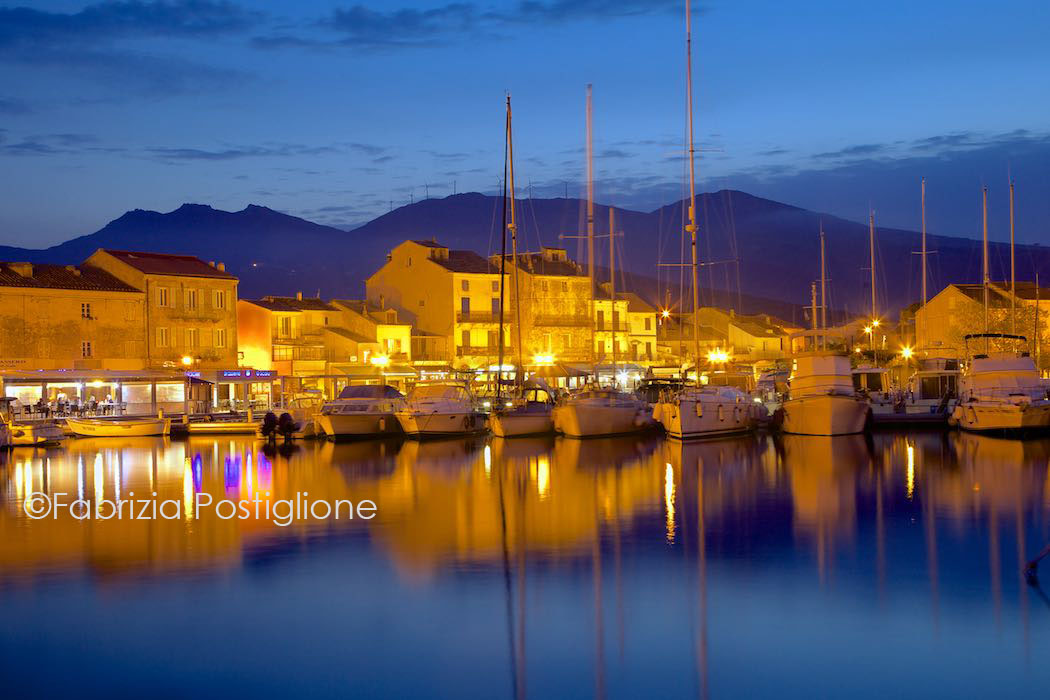
The masts of the yachts sway lazily at dusk and the shrouds screech moved by the mistral wind, while the crews feel busy preparing for dinner. If you still have energy, before sunset you can reach Tamarone beach for a last swim, or walk a stretch of the Sentiero dei Doganieri path (which reaches up to Barcaggio).
DAY 2: MACINAGGIO-PORT DE CENTURI
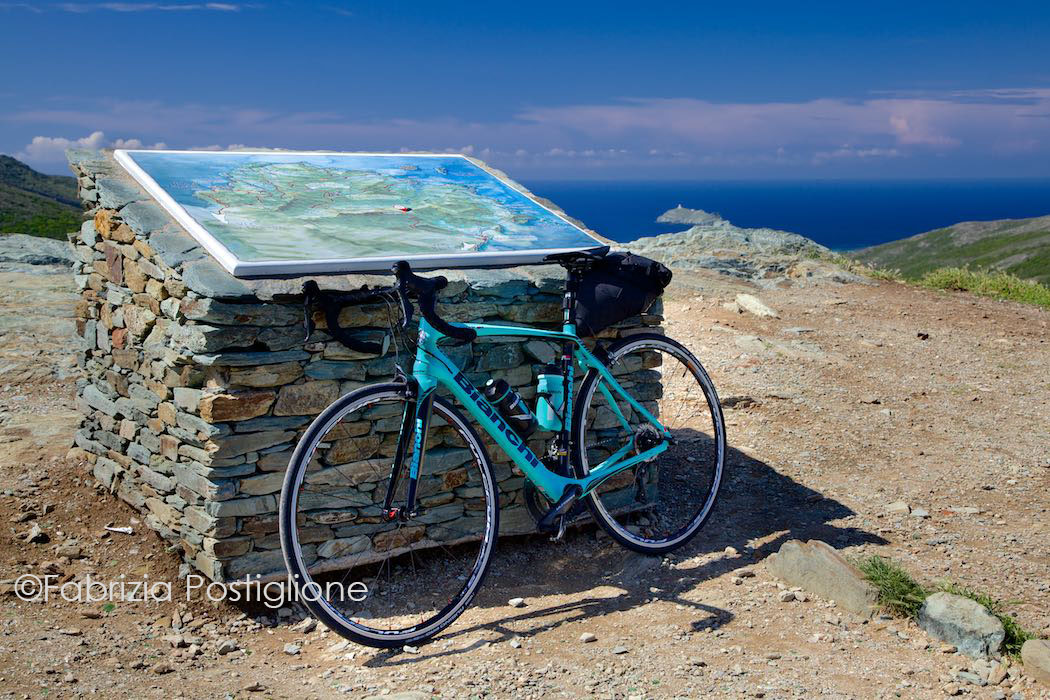
The second stage of the cycle tour involves the transition from the east to the west side of the peninsula. The road climbs gently towards the Rogliano viewpoint, which gives us the magnificent view of the north coast of Capo Corso and the island of Giraglia.
After the Col de Saint Nicholas, we turn downhill to Barcaggio. The road crosses the northernmost offshoot of the Serra, with slopes covered with maquis (Mediterranean scrub) blown by the wind, which soften towards the sea. The hamlet is actually a handful of houses with a tower: in Barcaggio we only have the vastness of the Mediterranean in front of us and there is not much else to do but a dip from the Plage de Barcaghjiu (to reach it you have to leave your bike and make a walk on a path) and then a fish lunch from U Fanale.
The road continues to the even tinier village of Tollare, located on the northernmost point of Corsica. From here the arduous climb to Ersa awaits us. Once you reach the panoramic Col de la Serra, the ride towards Port de Centuri is all downhill. With the bikes we can get right to the marina, among the colorful boats of the lobster fishermen for whom the village is famous. Three families compete for the primacy of catching coveted shellfish, which are offered in various ways in local restaurants. The most famous dish, however, is pâtes à la langouste (lobster pasta). In Macinaggio we admired the sunrise and, on the same day, in Port de Centuri we are enchanted in front of the sunset after a busy, hard but rewarding day.
DAY 3: PORT DE CENTURI-NONZA
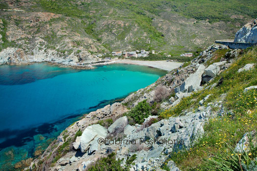
The third stage is the most scenic. It takes place all over the magnificent west coast and will take us to Nonza. We laboriously go up the D35 towards Caméra, where we return to the D80 towards the south. After the hamlet of Mucchieta (Morsiglia) which overlooks orderly vineyards, the curves become more and more panoramic and meander towards Anse d’Aliso, a paradise for a refreshing swim. In this shallow bay, the sapphire deep sea leaves room for incredible shades of turquoise and blue. In spring, the plants that make up the Mediterranean scrub (Phoenician juniper, red juniper, mastic, pine, thyme, rosemary, lavender, heather, myrtle, broom) explode with colors and scents and it is a great pleasure to pedal in this area where the mountain marries with the wave, “small beings” on two wheels on the border between sky and sea. After Anse d’Aliso, we start climbing again but the road never gets too steep. Between Pino and Minerviu we admire the overhanging coast that puts a strain on those who suffer from vertigo. When the winds blow from the western quadrant, the waves rage on the cliffs and the scenery becomes even more exciting. Once in Minerviu, after a few ups and downs, we pass the Gulf of Marine de Giottani, a Genoese-style settlement with a yacht harbor. For a seaside break we choose Marine d’Albu, which offers a large gray pebble beach guarded by a tower from the 1500s and is frequented by locals and romantic tourists looking for tranquility. The name Albu derives from the light color of the rocks that surround this fraction of Ogliastro. Those who do not want to dive into the sea can also take advantage of the natural pools that the Guado Grande river creates near the mouth. Thanks to the wind that almost always blows, the most practiced sports here are windsurfing and kite surfing.
For fishermen and the elderly, every rock, every island has a name. This testifies to the close relationship of the local people with the sea, which has always provided them with food, has allowed them to become merchants and travelers, but which has often constituted a threat, due to extreme meteorological events and to the barbarian invasions. That’s why many of the seaside villages are under the protection of Sant’Erasmo, the patron saint of fishermen.
We stop to eat a salad from U Snacku, which also offers sandwiches and organic lemonades, and then we return to the D80 to reach Nonza, announced by its gigantic black beach (a legacy of the former mine of Canari), reachable with five hundred steps. Considered the most picturesque one of the western shore, this village is perched on a rocky outcrop. Used as a set by the popular French TV drama Malaterra, it is always crowded with tourists. In the summer it is impossible to find parking, but luckily we don’t have this problem. We sneak into the cool interiors of Église Ste-Julie, which stands out with its pink facade in the center of the village along the D80, to see the polychrome altar made in Florence in 1693, then finally we treat ourselves to an aperitif made with local cheeses with fig jam at the Café de la Tour.
DAY 4: NONZA-BASTIA
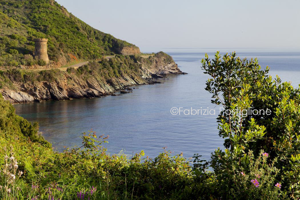
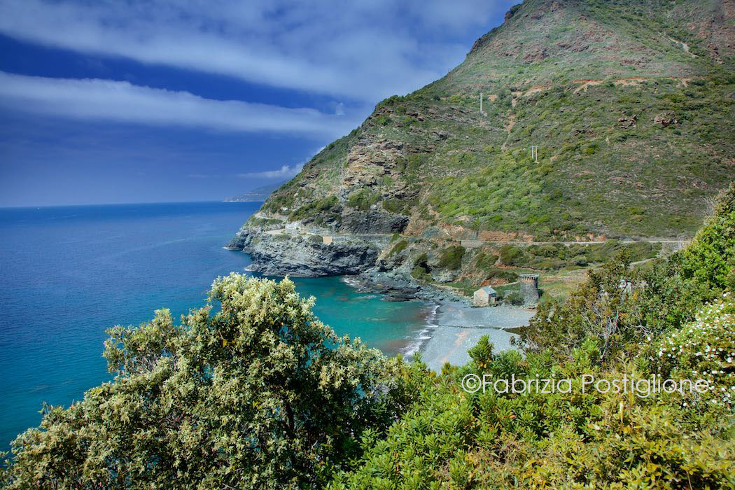
The last stage takes us further south. The coast gradually becomes less dramatic as we approach the Lilliputian hamlet of Marine de Negro (part of the municipality of Olmeta), protected by a sixteenth-century Genoese tower in good condition and surrounded by terraces cultivated with cedars, mandarins, olive trees. The D80 cuts arabesques into the rock a few meters from the surface of the water and riding becomes more agile. When we sight the beaches of Farinole, the change of scenery has now taken place: clear sand, gentle slopes, blue sea. We are close to Patrimonio, the wine capital of the Cap Corse, and to Saint Florent (which rises a few kilometers further south). We leave the coast and slide among the orderly geometries of the vineyards, then the road rears up and we begin to climb the Serra east, pitting panoramic curves and hairpin bends. It is a quite steep road to ride, so keep a steady pace and you’ll make it to the summit! We begin the descent towards Bastia enjoying the latest cycling emotions before meeting the city traffic and flowing on the promenade near the port.
ITINERARY IN DETAIL
STAGE 1: BASTIA – MACINAGGIO
Distance: 35,8 km
Riding time: 3 and a half hours (net of stops)
These are times for those who ride at a cycle tourist pace (maybe even carrying bags on the bike). Cyclists in training will obviously be faster.
Altitude gain: 547 m
Altitude loss: 550 m
Difficulty: medium-easy
GPS file: https://ridewithgps.com/routes/32312225
The first stage is the easiest. It takes place entirely along the east coast of Cap Corse, undulating and full of bays and villages on the sea, but without too steep tears. From Bastia take the D 80 and follow it north. Until Erbalunga, pay attention to the very intense traffic and the many ralentisseurs (bumps) in the inhabited centers. Between Erbalunga and Marine de Sisco the road climbs and reaches the maximum elevation of the journey (53 m. above sea level). From here it is a continuous rollercoaster, but without particular difficulties, up to Macinaggio. This side of the Cap Corse is jagged, but the road is wide enough and there are no fearful overhangs.
DAY 2: FROM MACINAGGIO TO PORT DE CENTURI
(VIA BARCAGGIO-TOLLARE-ERSA-CENTURI)
Distance: 34.8 km
Riding time: 4 hours
Altitude gain: 922 m
Altitude loss: 914
Difficulty: medium
GPS file: https://ridewithgps.com/routes/32312283
After Macinaggio, the D80 leaves the coast and gradually begins to gain altitude (first with a linear trend, then with gentle curves that follow the morphology of the mountainous terrain) pointing west. The climb is very easy to pedal, with slopes that are never too hard until the intersection with the D253 which leads to Barcaggio. Here we are at an altitude of 317 m. above sea level and we have gained 311 meters of altitude in a dozen kilometers. It begins to drop down to sea level. After the first handful of hairpin bends at Granaggiolo, the D253 continues losing altitude towards the north, winding but without sharp curves. Reached Barcaggio, continue on the D253 which turns west to reach Tollare. From this other microscopic fishing village, we start climbing again on the D153 towards Ersa and then towards the intersection with the D80 in Santa Maria, where we reach 303 m above sea level. From here, in about 4km (almost all downhill) we arrive at the junction for Port de Centuri, reachable by taking the steep and convoluted D35.
DAY 3: Port de Centuri – Nonza (via Centuri-Morsiglio-Pino-Minerviu-Marine d’Albo)
Distance: 44.3 km
Riding time: 5 hours / 5 and a half hours
Altitude gain: 1292 m.
Altitude loss: 1298
Difficulty: medium
GPS file: https://ridewithgps.com/routes/32312385
This stage begins with the very steep ascent from Port de Centuri along the D35 towards the D80: you can repeat the section already traveled downhill (about 4 km) or opt for the one that runs closest to the coast and in 5 km takes you back to the intersection with the D80 shortly after Baragogna (in both cases the climb is hard and the altitude gain is around 212 m: use the agile gears and take it easy). From here the road begins to descend again towards the blue Anse d’Aliso and the D80 offers ever more sensational views. After Anse d’Aliso, the asphalt snake starts to climb again, curve after curve, but the slopes are never prohibitive. Between Pino and Minerviu the overhanging coast is literally breathtaking and the road continues to rise. Once in Minerviu, we will have made an altitude gain of 402 m and, after a few small ups and downs, we will begin to lose altitude again towards Marine de Giottani. To get to the beach you then have to take the D133, otherwise continue on the D80 South which goes up to Marinca and then start the sinuous descent towards Marine d’Albou. From here it is almost entirely uphill to reach Nonza (which is located 4.6 km away).
DAY 4: Nonza-Bastia (via Farinole-Patrimonio)
Distance: 33.9 km
Travel time: 4 and a half hours
Altitude gain: 858 m
Altirude loss: 989 m
Difficulty: medium-high
GPS file: https://ridewithgps.com/routes/32312474
We start to descend again from Nonza towards Marine de Negro and, after returning to the interior to run over a bridge, the D80 resumes its coastal march, but this time the path is more gentle, it does not offer very high walls and dizzying overhangs. After Marine de Farinole, the coast becomes lower and the path bends inwards, it is more linear and less panoramic. After about 5km there is a roundabout and here you have to take the D81 (also called Route de Saint Florent) which leads to Bastia via Patrimonio. Past the well-known wine center, the road rears up in panoramic curves. Warning: it is a very busy route and the climb is quite steep: there are 669 m of altitude gain in a few kilometers. Go down to Barbaggio and begin to descend towards Bastia. When the Route de Saint Florent forks, turn slightly right to take the D264. After about 1 km, take a sharp bend on the left which takes you back to the D81, which you will follow until you reach a roundabout on the seafront (the D81 takes on various names when it enters the city). Here take the fourth exit on Avenue Pascal Lota (city name of the D80) towards the north for about 400 m and you will arrive in sight of the port of Bastia.
GPS file for the whole loop: https://ridewithgps.com/routes/32332298
WHERE TO STAY
Hotel L’Alivi ****
Bastia, Route de Cap, Tel. 04 95 55 00 00; hotel-alivi.com.
Just outside Bastia, at the beginning of Cape Corso, this modern-style hotel offers rooms with sea-view balconies, swimming pool surrounded by a lush garden, restaurant and private beach. Buffet breakfast.
Casa Maria
Nonza, Tel. 0033 4 95 37 80 95; casamaria-corse.com.
A small charming B&B obtained from an ancient building in the historical center of Nonza, just under the tower. It offers apartments and chambre d’hôte (rooms) furnished with traditional furniture and objects. Breakfast is served on the splendid sea view terrace.
Hôtel de la Jetée ***
Port de Centuri, tel. 33 9 70 35 61 51; hotel-de-la-jetee-centuri.fr.
Simple hotel, but with a magnificent view of the small port of Centuri, the capital of lobster fishing. Restaurant and bar on the beautiful panoramic terrace.
U Libecciu ***
Macinaggio, Route de la plage, tel. 33 495 354 322; u-libecciu.com. Family hotel a few minutes walk from Macinaggio beach. Private swimming pool, rooms with mini-bar and terrace. Friendly and helpful staff.
Hotel U Lustincone
Patrimonio, Lieu-dit Lustincone-Route du Cap, tel. 0033 33 4 95 37 15 28; u-lustincone.com. Farmhouse with swimming pool immersed in the vineyards of Patrimonio, the wine capital of Cape Corso. Ideal for those seeking tranquility and prefer to stop in the countryside before returning to Bastia.
WHERE TO DINE
La Sassa
Nonza, tel. 0033 4 95 38 55 26; castalibre.com/lasassa.
Amazing location (the tower of Nonza) overlooking the black beach. Corsican cuisine revisited, cocktails, live music (jazz, Latin). Perfect for a sunset cocktail or a chic dinner. Reservations needed. Average bill: € 40-45
Morganti
Ogliastru, Marina d’Albu, tel. 0033 4 95 37 85 10; restaurantmorganti.com. You sit under a large tree that gives a pleasant coolness on summer days and you taste excellent fish and meat dishes presented very well: goat cheese spring rolls with maquis (Mediterranean scrub) honey and hazelnut chantilly; duck breast with ratatouille; Cape Corse fish soup. For dessert, try the pastizzu (traditional dessert from northern Corsica made with stale bread, milk, sugar, eggs and butter) with caramel sauce. Average bill: 45 €.
L’Esquinade
Erbalunga, Le Port, tel. 0033 4 95 33 22 73.
Nice restaurant with a terrace on the Erbalunga marina. Fish and meat menu (rock fish soup, Agneau confit au jus de figues, Charcuterie). For dessert, macarons à la rose and Corsican cheeses with fig jam are very popular.
Average bill: € 35-40.
Au Vieux Moulin
Centuri, Tel: 0033 4 95 35 60 15; le-vieux-moulin.net.
The restaurant is housed in a hotel on the marina and offers Mamie Josette’s traditional seafood recipes, such as the famous Pâtes à la langouste de Centuri (pasta with Corsican lobster) and the Capo Corso cedar mousse.
Average bill: € 38-40.
L’Auberge du Chat Qui Pêche
Canari, tel 0033 4 95 37 81 52; aubergeduchatquipeche.com.
Restaurant with tables in the street, right along the D80, or in a beautiful room with stone and brick walls decorated in a rustic chic style, it is one of the most popular among travelers riding or driving the scenic road. It offers Corsican charcuterie (cold cuts sourced from free-range local pork raised in the island’s mountainous areas, famous for their authentic flavors and a tender texture) and fish dishes, such as gambas à la paysanne(prawns with parsley, garlic, olives and bacon). Average bill: € 35.
WHERE TO SNACK
U Fanale
Ersa, 1 Barcaggio, tel. 0033 4 95 35 62 72.
U Snacku
Ogliastro, Marine d’Albu, tel. 00 33 6 52 72 26 07.
Café de la Tour
Nonza, Route du Cap, tel. 0033 4 95 37 82 04.
TOURIST INFO
Office de Tourisme du Cap Corse Rogliano-Macinaggio
Macinaggio (Rogliano), Base Nautique-Port de Plaisance, Tel. 0033 (0)4 95 35 40 34; http://macinaggiorogliano-capcorse.fr.
Communauté des Communes du Cap
U campu Résidence les Jardins d’Erbalunga – Bât A et B
Brando, Tel : 0033 4 95 31 02 32; destination-cap-corse.com
Office de tourisme de la la Communaute d’Agglomeration de Bastia
(which includes: Bastia, Furiani, Ville de Pietrabugno, Santa Maria di Lota, San Martino di Lota)
Bastia, Place Saint Nicolas-Avenue Pierre Giudicelli, tel. 0033 4 95 54 20 40; bastia-tourisme.corsica.


